Marquette Underwater Preserve
 Being Michigan’s largest city in its Upper Peninsula and having an ideal natural harbor, the Marquette area has played an important role in Michigan’s maritime history. It developed rapidly as a commercial center after the discovery of iron ore in 1844. Many ships have visited the Marquette coast and more than a few were lost to weather and storms there.
The Marquette Underwater Preserve is unique in that it is comprised of two “Units”. The Marquette Unit borders 24 miles of Upper Peninsula coastline extending out into Lake Superior to a depth of 200 feet. The Huron Islands Unit embraces the clear waters surrounding the Huron Islands west of the Marquette Unit– a group of granite upcroppings rising from the bottom of Lake Superior.
The Huron Islands Unit has some of the most impressive coastline in Michigan. The shore ranges from sandy beaches to towering cliffs backed by the scenic Huron Mountains. Boaters can reach the Huron Islands from the Big Bay Harbor of Refuge at Big Bay or from Wirtz’s Marina at Skanee in Baraga County. In either case, it is a cruise of over 12 miles to the Islands, so boaters must take appropriate precautions.
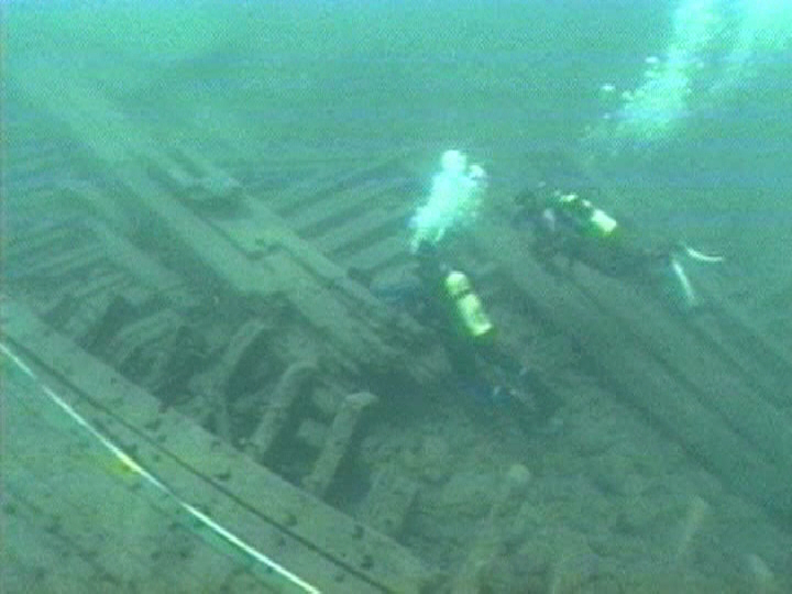
The shipwrecks Charles J. Kershaw and D. Leuty are buoyed during the dive season by Diver Down Scuba Shop in Marquette. Divers should be prepared and ready to locate other sites on their own.
In addition to shipwrecks, the Marquette Underwater Preserve has many docks and cribs for divers to explore along with unique geology to examine. Presque Isle offers excellent shore diving and boasts some interesting geologic formations. It is a popular local dive site.
The “Gold Mine Pinnacle” is a boat dive that is also popular. It is just offshore from Presque Isle. Depths vary widely from ten feet to depths outside recreational limits. This variance makes it an advanced dive.
Visitors can tour the Marquette Maritime Museum located at 300 Lakeshore Boulevard in Marquette to learn more about the history of the area. It keeps seasonal hours so check before you go.
The Marquette area hosts a variety of seasonal activities that will be of interest to divers and non-divers alike. More information is available at the websites for the Marquette Convention and Visitor’s Bureau, and Marquette Chamber of Commerce.
Shipwrecks & Dive Sites
| Wreck Name & Year Lost | Depth | GPS/LAT/LON |
|---|---|---|
| Arctic (1860) | 5′ to 105′ | N 46° 57.740 W 087° 59.850 |
| DeSoto (1869) | 8′ to 10′ | N 46° 32.070 W 087° 23.550 |
| F-106B Fighter Plane (1974) small debris only | 20′ to 22′ | N 46° 31.710 W 087° 23.275 |
| Florida (1886) | 10′ to 15′ | N 46° 32.110 W 087° 23.530 |
| “Gold Mine” Pinnacle | 12′ to 150′ | N 46° 35.380 W 087° 21.750 |
| “Iron Man” & J.H. Sheadle (1920) | 15′ | N 46° 34.080 W 087° 23.170 |
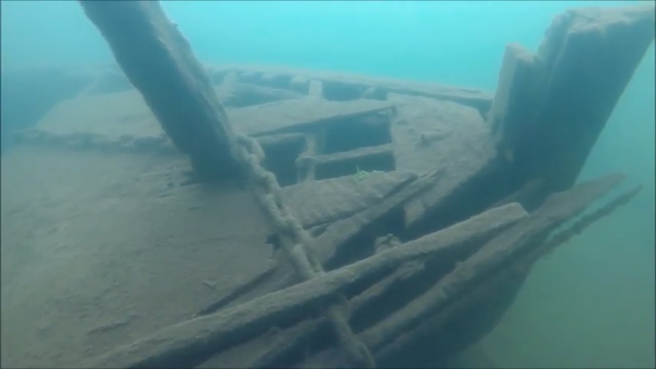
| Charles J. Kershaw (1895) | 25′ | N 46° 30.560 W 087° 21.810 |
| D. Leuty (1911) | 40′ | N 46° 32.760 W 087° 22.440 |
| George Nester (1909) | 20′ to 100′ | N 46° 57.990 W 088° 00.200 |
| Queen City (1864) | 10′ to 13′ | N 46° 29.553 W 087° 18.640 |
| George Sherman (1887) | 10′ to 12′ | N 46° 29.890 W 087° 09.630 |
| Southwest (1898) | 100′ | N 46° 56.420 W 087° 56.110 |
| Superior & Marion L. | 20′ | N 46° 32.500 W 087° 23.350 |
Among the best shipwreck dives in the Marquette Preserve – Huron Islands Unit are:
Southwest
The Southwest, launched in 1866, is the most popular dive site of the Huron Islands Unit. This 137 foot sailing vessel ran aground one and one half miles southeast of the largest of the Huron Islands. She was running in a heavy fog on September 18, 1898 when the disaster occurred. Today, divers will find the remains of the Southwest scattered in 100 feet of water. Many small artifacts remain in clear water which makes an especially appealing dive.
Arctic
The Arctic was caught in fog and lost near Huron Island on May 28, 1860. The remains of the 237 foot long side-wheel steamer rest on a steep incline with depths varying from 5 to 105 feet of water.
George Nestor
Located near Huron Island’s lighthouse is the wreckage of the 207 foot long George Nestor. She stranded there in a storm on April 30, 1909 and seven of her crew died. The schooner-barge has water depths ranging from 20 to more than 100 feet.
Among the best shipwreck dives in the Marquette Underwater Preserve Marquette Unit are:
Charles J. Kershaw
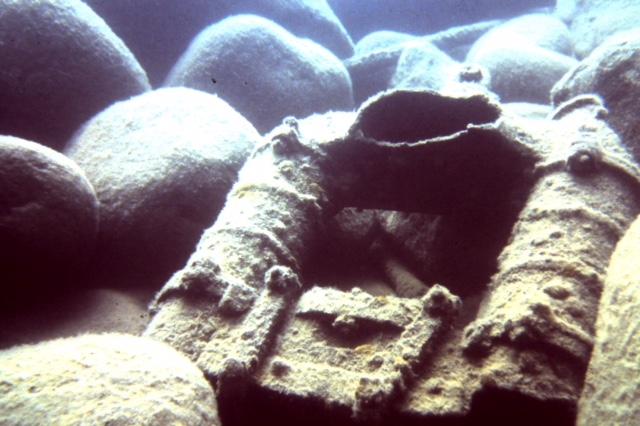
The Kershaw foundered in a storm while towing two schooner- barges on September 29, 1895. The 223 foot long wooden steamer lost power and her crew was rescued by the Marquette Life Saving Service. The Kershaw went to pieces in shallow water. Today she lies scattered and broken in about 25 feet of water. Her substantial boiler is a dive highlight.
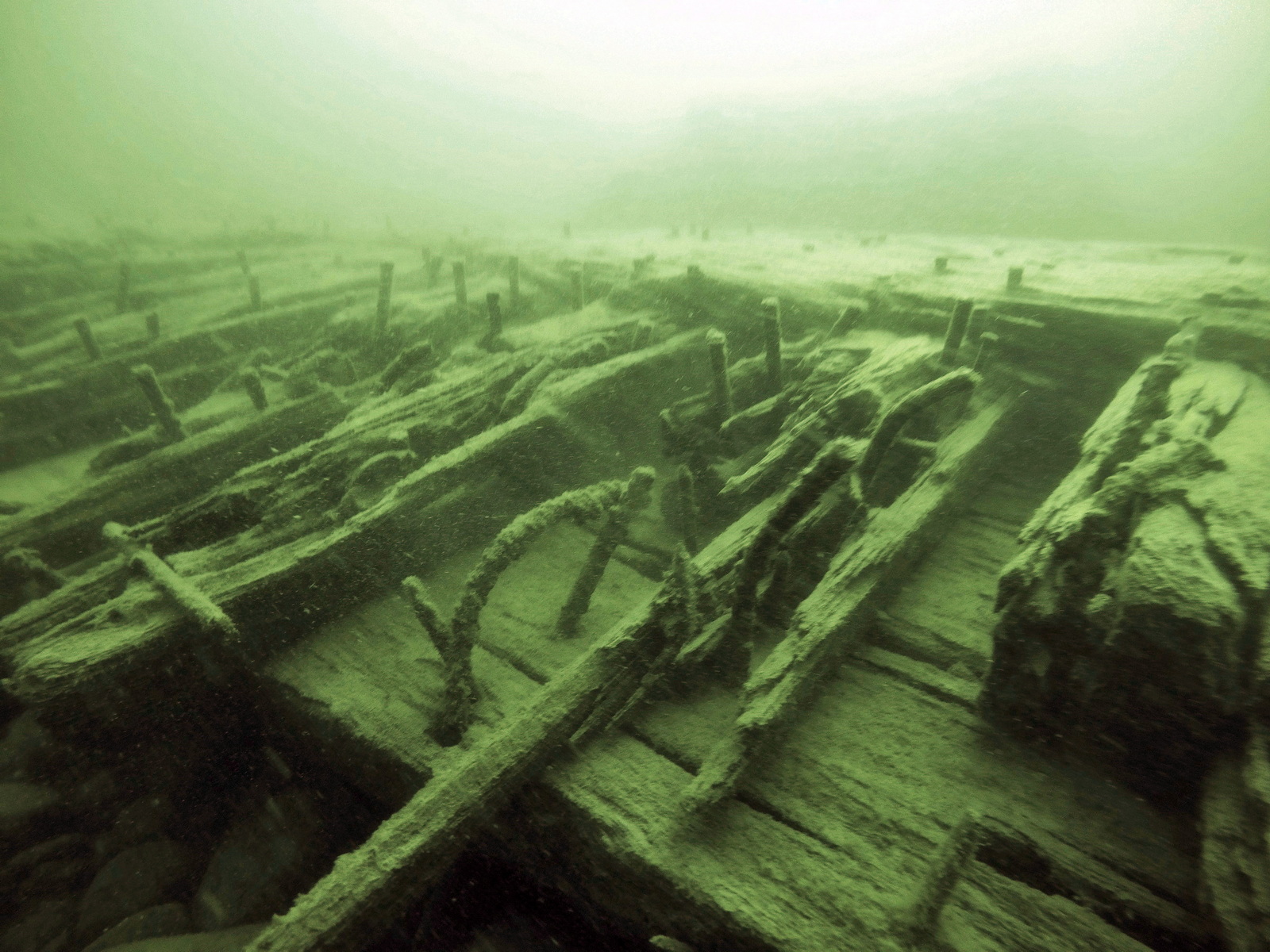
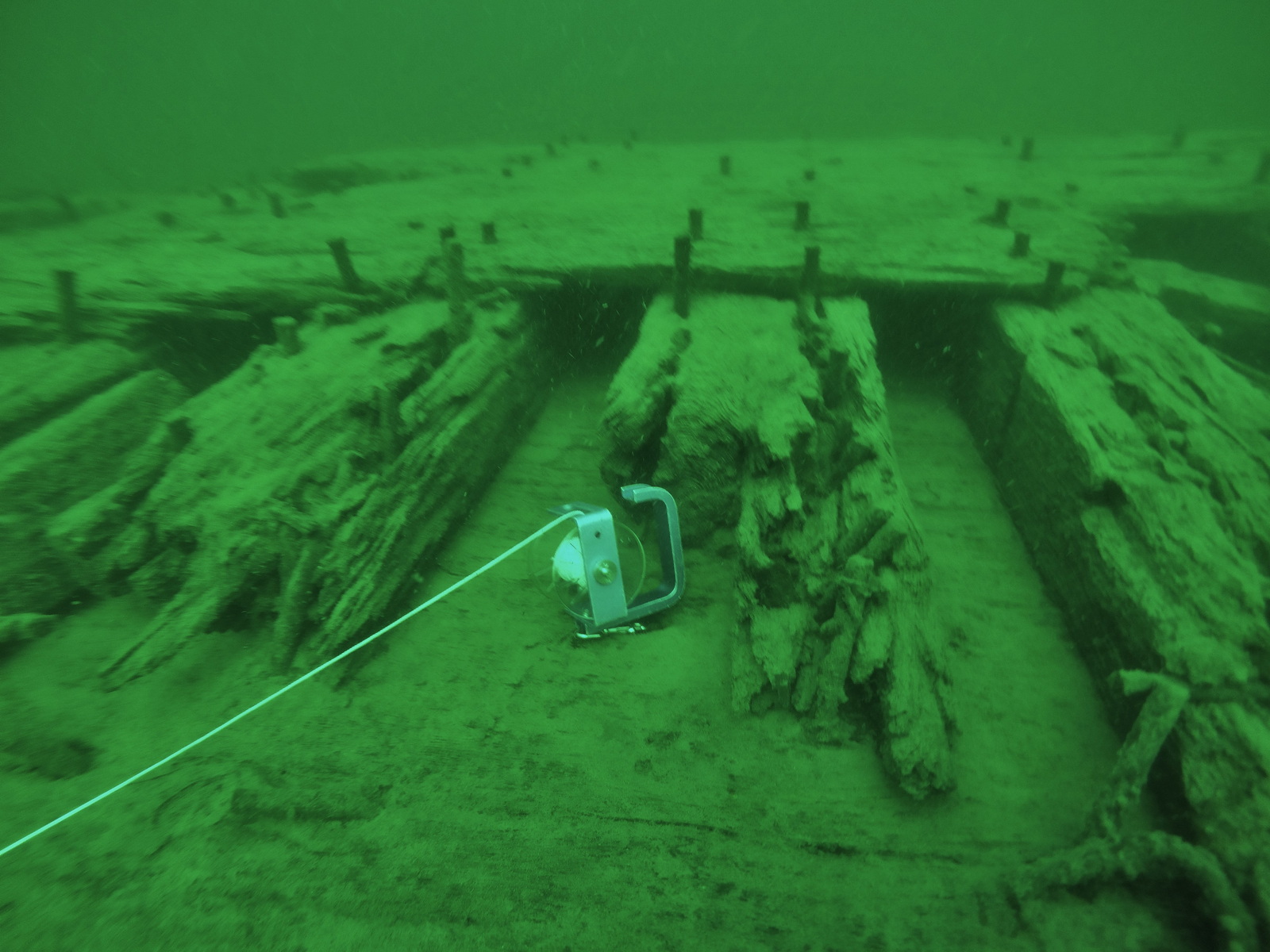
D. Leuty
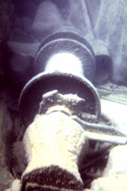
This ship was lost while struggling to enter Marquette harbor on October 31, 1911 with a cargo of logs. The Leuty came to rest about 800 feet off Lighthouse Point near downtown Marquette. Despite her proximity to shore, this is a boat dive because the nearest public access site is about ¼ mile away. The ship is broken up and her engine, boiler and machinery were salvaged. Three large parts of the hull and her large rudder remain in about 40 feet of water. Divers will also see tools, fasteners and piping scattered in more shallow water.
Florida
The Florida was a two masted schooner built at Oswego, New York in 1868. She met her fate in a blizzard on November 17, 1886. She was crushed against the Marquette docks with the loss of one life. The ship’s remains are now in shallow water and covered with shifting sand. Her framing and planking are just outside the cribs of an old dock.
DeSoto
This schooner was launched April 10, 1856. She stranded and broke up on December 4, 1869. Her framing and planking are in about 10 feet of water and make an easy novice dive or snorkeling opportunity.